Australia’s living skin bared in stunning three dimensions
The entire country is now represented as a digital grid with two billion ‘pixels’ that are about 90 by 90 metres, down to a depth of two metres below the surface.
The Soil and Landscape Grid of Australia, launched today at the National Soil Science Conference in Melbourne, is the result of a partnership between CSIRO, the University of Sydney, several federal, state and territory government agencies and the Terrestrial Ecosystem Research Network (TERN).
The Grid draws information from the partner agency databases weaving together both historical and current data generated from sampling, laboratory sensing, modelling and remote sensing.
The Grid also includes estimates of reliability and is designed to integrate new data in the future – even data generated by technology that has not yet been invented.
Soil and landscape attributes such as soil water, nutrients and clay, affect the sustainability of Australia’s natural resources and the profitability of sectors such as agriculture, mining and infrastructure.
“From exploring new land use options, to making the most of water, to finding habitats for endangered native species, this technology has applications we are only just beginning to imagine.”
Mike Grundy
CSIRO Research Director Mike Grundy said the Grid had already woven together hundreds of millions of dollars’ worth of past soil and landscape science into a new ‘digital tapestry’.
“The research community has known we need better ways to make this diverse information available; new science and technology has let us make the most of the rich data we have,” Mr Grundy said.
“From exploring new land use options, to making the most of water, to finding habitats for endangered native species, this technology has applications we are only just beginning to imagine.”
The Grid will be beneficial to a wide range of applications and users including urban and regional planners, land managers, farming groups, scientists and engineers.
Alexandra Gartmann, CEO at Foundation for Rural & Regional Renewal and former CEO of Birchip Cropping Group, has worked with rural industries for almost two decades. Ms Gartmann said she was excited by the new technology.
“Knowledge is power, and our agricultural industries have a very narrow margin for error these days, so the more knowledge to reduce poor decisions, the better,” Ms Gartmann said.
“Agribusiness will benefit from this technology, both at the farm scale — with data to inform production models and risk management decisions — and industry scale, as it draws together many years of past research and knowledge for future investment decisions.
“The Soil and Landscape Grid is a huge leap forward. With its national datasets and consistent and comparable data, it has huge potential for regional development, informing planning and decision-making.”
Find out more
Media resources
Click image for high resolution version
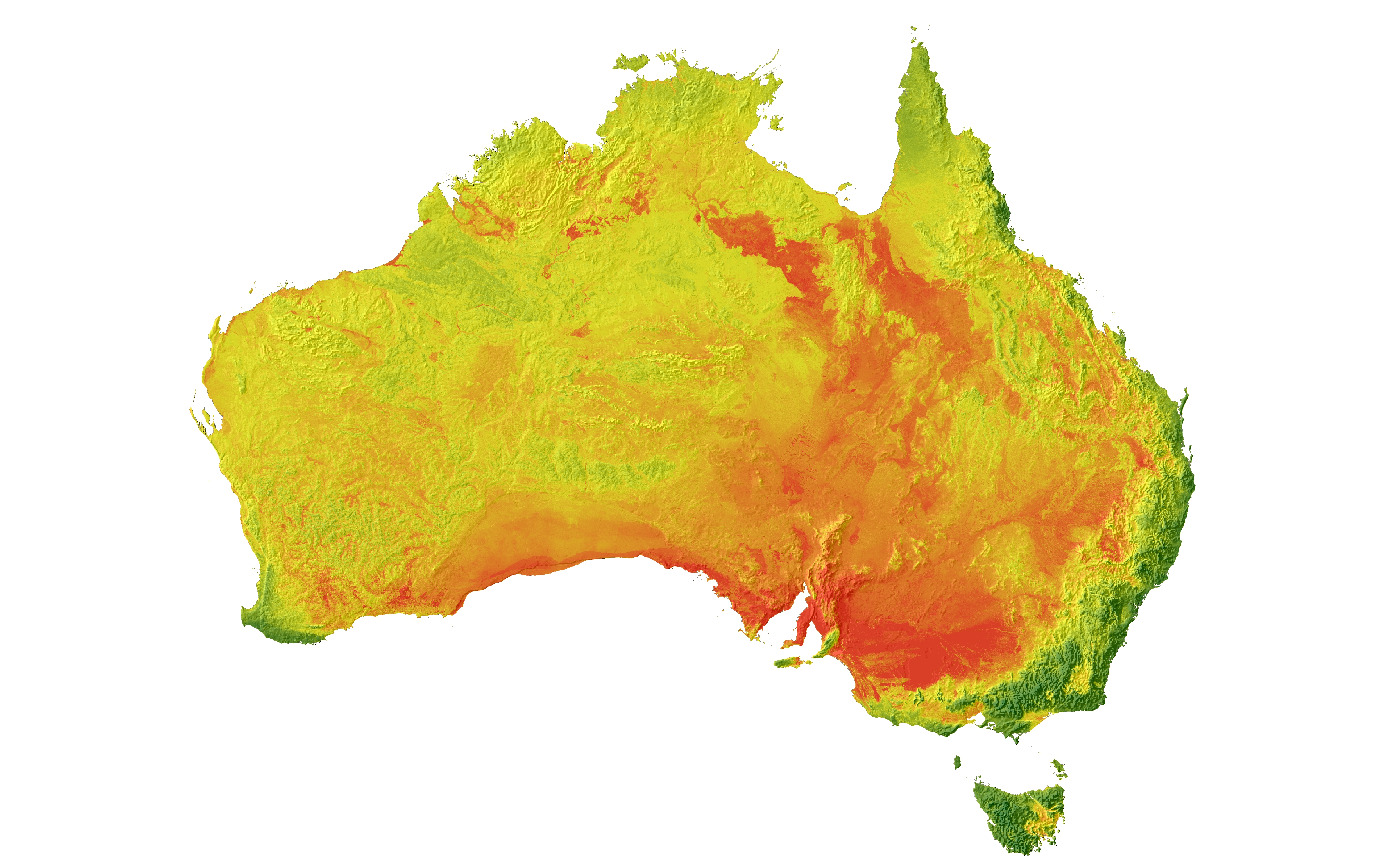
Australia-wide image of pH at 100-200 cm average depth. Image: CSIRO
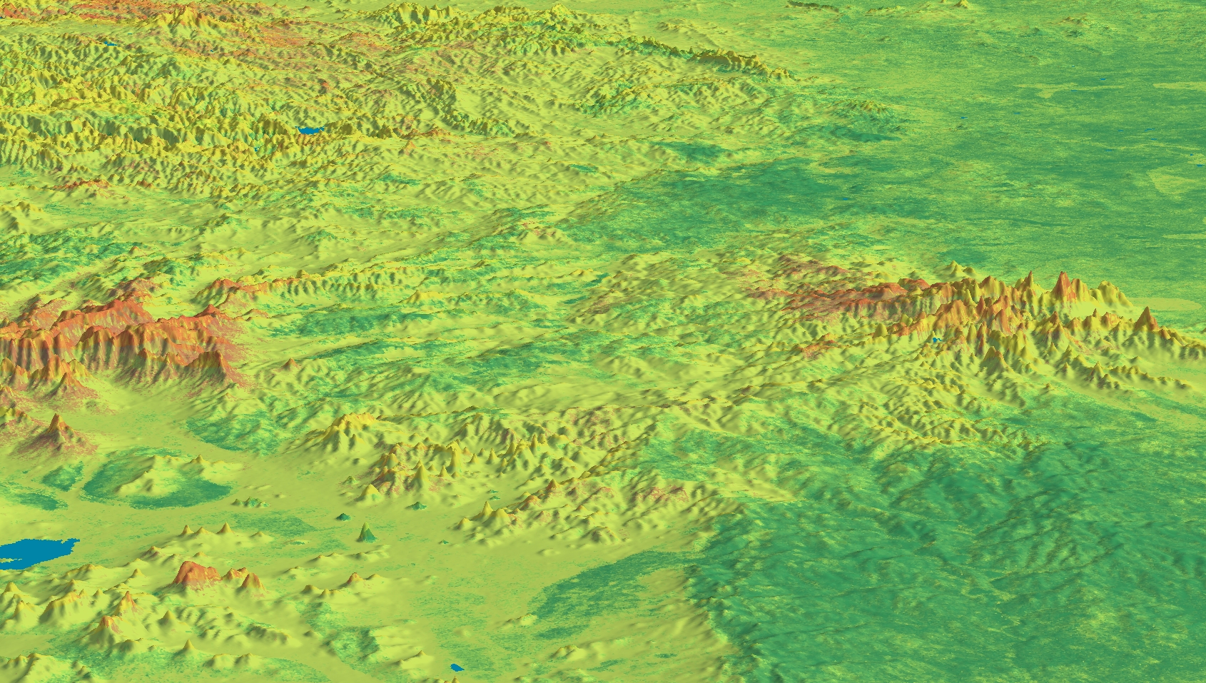
Total Nitrogen at soil surface (0-5cm average). Image: CSIRO
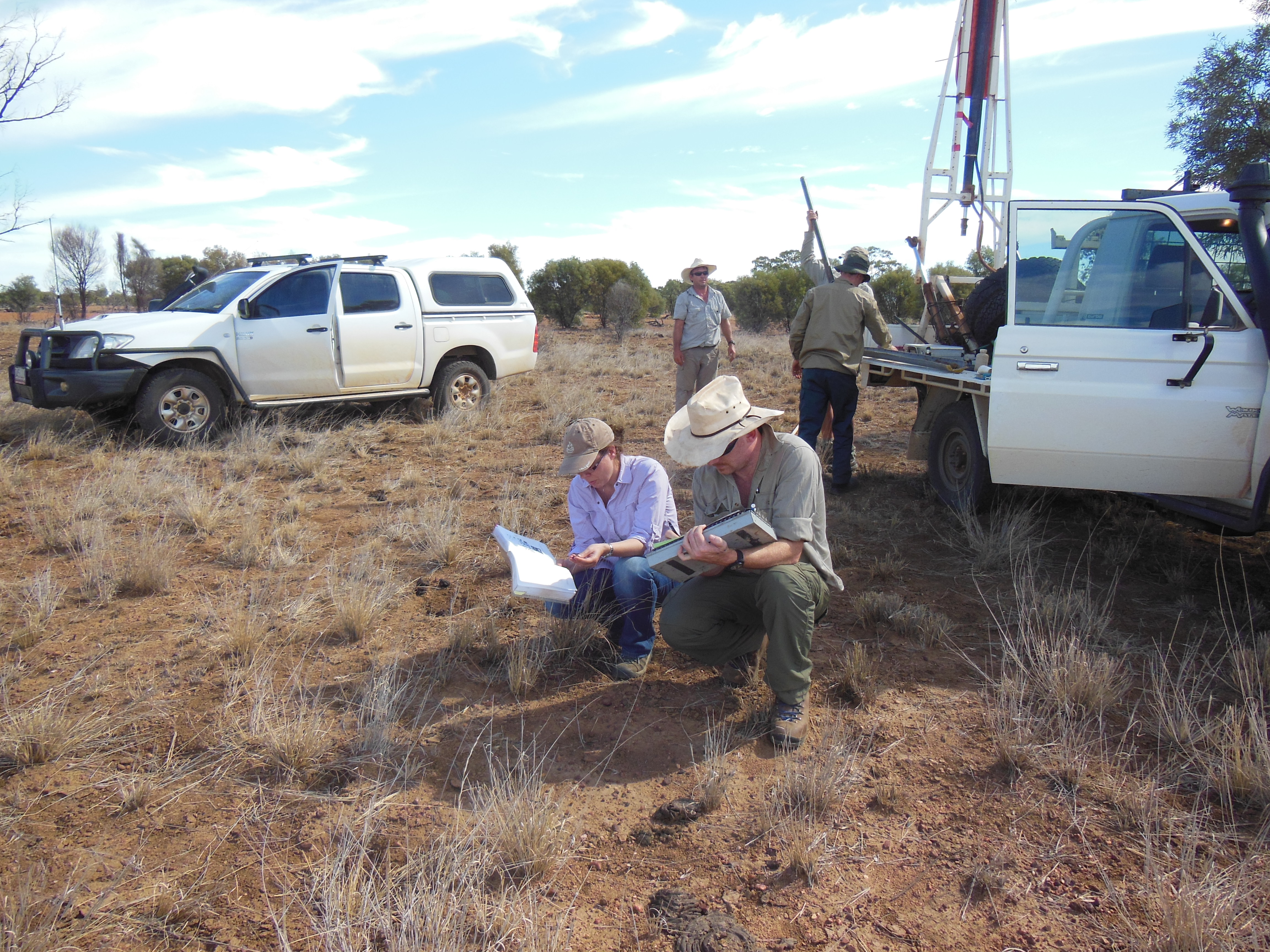
Soil sampling provides important data for the Grid and many parts of Australia have little data available. Image: Rebecca Bartley, CSIRO
More resources: